

Hurricane Helene has been downgraded to a category one storm but authorities warn rainfall and winds are still a danger.

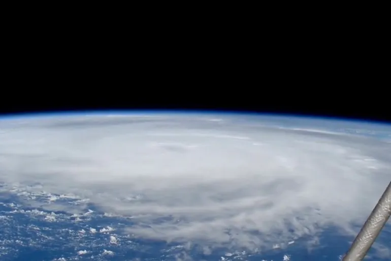
Satellite image shows Hurricane Helene churning through the Gulf of Florida, September 26, 2024 [Reuters]
Hurricane Helene struck Florida’s Big Bend region on Thursday night, classed as a category four storm with potential to inflict significant damage and loss of life. Thousands of residents were evacuated, and nearly the entire state was placed under alert.
Hurricane Helene is now classified as category one, less severe but still considered dangerous. Authorities warned that rainfall and winds still pose a danger to people in Florida, Georgia and the Carolinas.
Here’s what we know about Hurricane Helene, its impact on Florida and its trajectory across the US.
What happened when Hurricane Helene hit Florida?
- Hurricane Helene made landfall at about 03:10 GMT on Thursday night (23:10 Eastern Standard Time) with maximum sustained winds estimated at 225 kilometres per hour (140 miles per hour).
- As a category four storm, it was the most powerful ever to hit the state’s Big Bend region. Some hours later, at about 06:40 GMT, authorities downgraded the hurricane to category one but warned that heavy rainfall and strong, damaging winds still posed a significant threat.
- Fallen trees brought down power lines across the state and, as of 06:40 GMT, almost 1.3 million people in Florida were without power, according to tracking site poweroutage.us. Florida has a population of 22 million people.
- Earlier, the weather service warned people to treat the strong winds “like a tornado is coming and quickly move to an interior room or shelter NOW!”
- Florida Governor Ron DeSantis has urged residents to remain indoors and avoid roadways as significant storm surge from Helene floods the streets and creates dangerous conditions.
Which direction is Hurricane Helene moving?
- Helene landed near the mouth of the Aucilla River in the Big Bend area of Florida’s Gulf Coast.
- At 05:00 GMT local authorities said Helene was moving northwards to Georgia. The National Hurricane Center said the eyewall – the part of the storm with the strongest winds underneath it – was entering the southern part of the state.
- Authorities said damaging winds will be felt across Georgia and the Carolinas throughout Friday, especially in the higher areas of the Southern Appalachians in North Carolina.